
In his doctoral research at NMBU, Fetullah Atas has introduced sophisticated techniques that significantly advance the autonomy of robots navigating challenging, uneven terrains.
These innovations promise to positively impact automation in agriculture, forestry, and search and rescue fields.
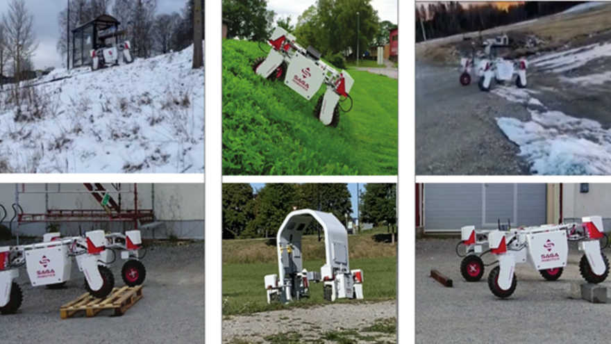
Fetullah Atas's doctoral research tackles the challenges robots encounter in three-dimensional environments where there is little to no structure, such as no clear road markings or predetermined paths. The proposed algorithms help robots navigate autonomously, allowing them to recognize and respond to obstacles in real-time more effectively.
“This significantly lowers the chances of mission failures," Atas explains.
"It's crucial for these machines to accurately analyze their surroundings to avoid hazards like rocks, potholes, or steep bumps that could cause them to tip over or become trapped," he adds.
Atas has dedicated his research to refining these algorithms, enhancing how robots understand and interact with the natural environment. This is pivotal for improving the safety and efficiency of robots used in diverse fields such as agriculture and disaster recovery.
Innovative Contributions Across Four Key Areas
Atas’ thesis encompasses six papers showcasing a comprehensive approach to solving the challenges of robotic navigation in uneven terrains.
- Advanced Motion Planning: "We've identified and enhanced sampling-based planners suitable for outdoor navigation. We have also developed 'CostTrust,' a kinodynamic algorithm that pushes the performance boundaries of these systems," states Atas. This algorithm notably improves planning efficiency and robot reliability in unpredictable terrains.
- Efficient Environmental Representation: The thesis introduces innovative algorithms utilizing intermediate point cloud representations to support both sampling-based and classical graph-based planning algorithms. "Unlike standard methods, our approach comprehensively represents complex scenes, improving navigation accuracy and efficiency," Atas says.
- Accurate Traversability Estimation: Addressing the challenges in assessing terrain navigability, Atas has developed a deep neural network that integrates various data to predict terrain traversability dynamically. "Our method offers a more reliable way to estimate terrain navigability based on a robot's direction and experiences," he explains.
- Practical Application and Real-World Testing: The 'vox_nav' framework, introduced in his research, integrates these advanced algorithms into a practical software solution for real-world application. "This framework has been successfully tested on diverse outdoor terrains, proving its robustness and adaptability," Atas notes.
Looking to the Future
As Atas prepares for future research, he reflects on the implications of his work.
"The integration of these advanced techniques opens new possibilities for deploying autonomous robots in previously inaccessible environments. Our next steps will involve refining these technologies to enhance their efficiency and adaptability further," he concludes.
Fetullah Atas will defend his PhD thesis "Traversablity-guided Planning for Efficient Robot Navigation in Uneven Terrains" on 16 May 2024. Read more about the event here.
Contact
For inquiries or further details about his approach to robotic navigation, please contact Fetullah Atas.